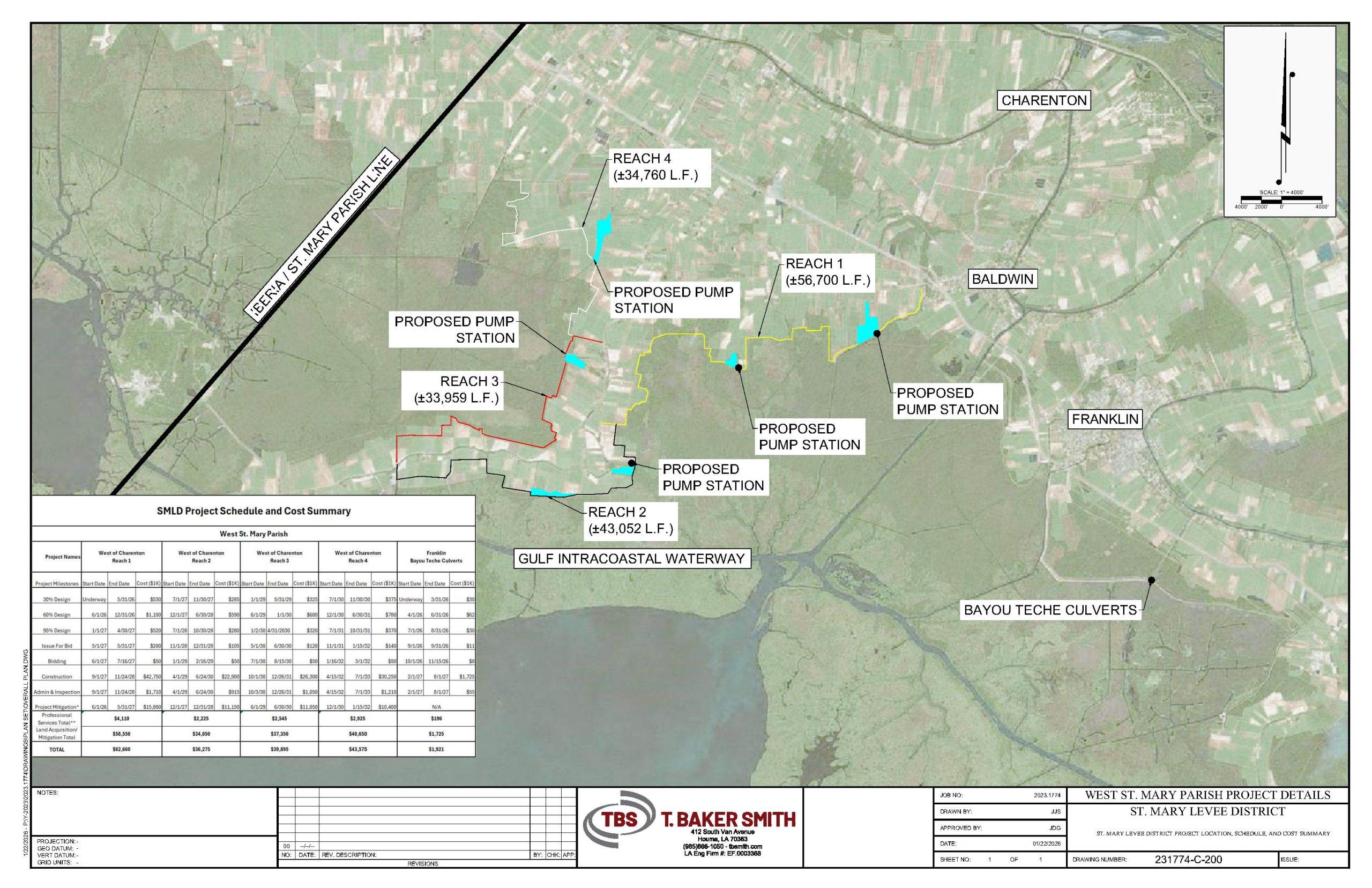
The project has been broken into 4 different reaches. Reach 1 is currently in E&D to the point of being able to start the permitting process. Reaches 2 & 3 are in the modeling phase. See the map below that shows the levee reaches and possible drainage and floodgate scenarios.
Historically, high rivers have caused flooding issues and habitat loss due to inundation of freshwater in an area that was previously brackish. SMLD is working towards shovel ready projects in order to start construction as funding is available.